Suchergebnisse für: "europa karte"
-
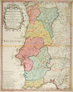 PORTUGAL. - Karte. - Regnum Portugalliae.
Altkol. Kupferstich von J.B. Homann, um 1720, 60 x 46,5 cm.
Flächenkolorierte Gesamtkarte, mit Titelkartusche links oben und Legende unten. - Obere und untere rechte Ecke wasserrandig, unten knapprandig. Bug gebräunt. Frisches Kolorit. (Artikelnr. 26775CG)
Erfahren Sie mehr200,00 € Inkl. MwSt. -
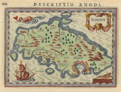 RHODOS. - Karte. - Descriptio Rhodi.
Altkol. Kupferstich aus Bertius, Amsterdam, 1618, 9 x 13 cm.
Zeigt die Insel mit Hafen, Ortschaften und Bergen, im Meer ein Delphin und ein Dreimaster, rechts unten Kompaß und Zirkel, oben Inschrift. - Verso Typographie. (Artikelnr. 31186EG)
Erfahren Sie mehr160,00 € Inkl. MwSt. -
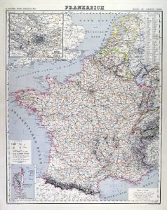
FRANKREICH. - Karte. - Frankreich.
Grenzkol. Kupferstich von Dekinder und Seitz aus Kiepert bei Reimer, Berlin, 1858, 55,5 x 44 cm.
Espenhorst, PP 20.1.1. - Aus: Heinrich Kiepert's "Neuer Handatlas über alle Theile der Erde" (Ausgabe 1858). - Gesamtkarte mit zwei Nebenkart... (Artikelnr. 19022BG)
Erfahren Sie mehr80,00 € Inkl. MwSt. -
FRANKREICH. - Karte. - Frankreich.
Grenzkol. Kupferstich von Dekinder und Seitz aus Kiepert bei Reimer, Berlin, 1875, 55,5 x 44 cm.
Espenhorst, PP 20.1.2. - Aus: Heinrich Kiepert's "Neuer Handatlas über alle Theile der Erde" (Ausgabe 1875). - Berichtigt 1874. - Gesamtkarte... (Artikelnr. 19044BG)
Erfahren Sie mehr80,00 € Inkl. MwSt. -
FRANKREICH. - Karte. - Frankreich.
Grenzkol. Lithographie nach Theinert aus Sohr bei Flemming, Glogau, um 1850, 30 x 35 cm.
Espenhorst, PP 4.1.1. - Aus: Karl Sohr's "Vollständiger Universal=Handatlas der neueren Erdbeschreibung". - Mit Grenzkolorit für die 16 alten Provin... (Artikelnr. 35235EG)
Erfahren Sie mehr80,00 € Inkl. MwSt. -
FRANKREICH. - Karte. - Frankreich.
Grenzkol. Kupferstich von Dekinder und Seitz aus Kiepert bei Reimer, Berlin, 1871, 55,5 x 44 cm.
Espenhorst, PP 20.1.2. - Aus: Heinrich Kiepert's "Neuer Handatlas über alle Theile der Erde" (Ausgabe 1871). - Berichtigt 1870. - Gesamtkarte... (Artikelnr. 19096BG)
Erfahren Sie mehr80,00 € Inkl. MwSt. -
 FRANKREICH. - Karte. - Frankreich.
Grenzkol. Kupferstich von Dekinder und Seitz aus Kiepert bei Reimer, Berlin, 1861, 55,5 x 44 cm.
Espenhorst, PP 20.1.1. - Aus: Heinrich Kiepert's "Neuer Handatlas über alle Theile der Erde" (Ausgabe 1861). - Gesamtkarte mit zwei Nebenkart... (Artikelnr. 19140BG)
Erfahren Sie mehr80,00 € Inkl. MwSt. -
ITALIEN. - Karte. - Italien.
Grenzkol. Lithographie von Thomas nach Theinert aus Sohr bei Flemming, Glogau, um 1850, 30 x 35 cm.
Espenhorst, PP 4.1.1. - Aus: Karl Sohr's "Vollständiger Universal=Handatlas der neueren Erdbeschreibung". - Mit Grenzkolorit für die 8 it... (Artikelnr. 35244EG)
Erfahren Sie mehr90,00 € Inkl. MwSt. -
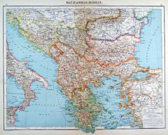 BALKAN. - Karte. - Balkanhalbinsel.
Farblithographie nach Wolf aus Spamer, 1902, 31,5 x 41,5 cm.
Espenhorst, PP 23.2. - Aus: O. Spamer's "Grosser Hand-Atlas" (2. Ausgabe, Auflage 1902). - Zeigt das Gebiet von Hermannstadt bis zum Peloponnes, im Westen Süditalien, im Osten d... (Artikelnr. 35100EG)
Erfahren Sie mehr100,00 € Inkl. MwSt. -
GRIECHENLAND. - Karte. - Griechenland.
Farblithographie nach Wolf aus Spamer, 1902, 31,5 x 41,5 cm.
Espenhorst, PP 23.2. - Aus: O. Spamer's "Grosser Hand-Atlas" (2. Ausgabe, Auflage 1902). - Zeigt das Gebiet von Chalkidike bis Kreta, im Osten die Westküste der Türkei. - Verso... (Artikelnr. 35102EG)
Erfahren Sie mehr100,00 € Inkl. MwSt. -
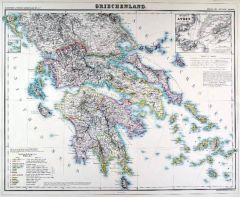 GRIECHENLAND. - Karte. - Griechenland.
Grenzkol. Lithographie von Sulzer aus Kiepert bei Reimer, Berlin, 1871, 45 x 55,5 cm.
Espenhorst, PP 20.1.2. - Aus: Heinrich Kiepert's "Neuer Handatlas über alle Theile der Erde" (Ausgabe 1871). - Berichtigt 1870. - Schöne Gesamtkarte vo... (Artikelnr. 19105BG)
Erfahren Sie mehr100,00 € Inkl. MwSt. -
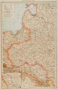 POLEN. - Karte. - Westrussland.
Farblithographie nach Scrobel aus Andree bei Velhagen & Klasing, 1893, 36,5 x 23,5 cm.
Espenhorst, PP 5.1.3. - Aus: Richard Andree's "Allgemeiner Handatlas" (3. Ausgabe, Auflage 1893). - Zeigt das Gebiet von Dorpat im Norden bis Debreczin ... (Artikelnr. 35557EG)
Erfahren Sie mehr70,00 € Inkl. MwSt. -
48,00 € Inkl. MwSt.
-
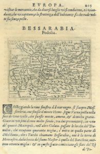 AUSSCHWITZ. - Karte. - Ducatus Osroiczensis et Zatoriensis descriptio. Gebietskarte.
Kupferstich bei Botero, um 1590, 7,5 x 11 cm (auf der vollen Buchseite). (Artikelnr. 16388CG)
Erfahren Sie mehr85,00 € Inkl. MwSt. -
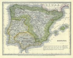 SPANIEN und PORTUGAL. - Karte. - Hispania. Gesamtkarte mit Portugal.
Grenzkol. Stahlstich nach Renner aus Meyer's Groschen-Atlas, um 1860, 21 x 27 cm. (Artikelnr. 20168CG)
Erfahren Sie mehr38,00 € Inkl. MwSt. -
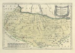
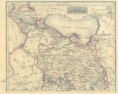 SCHWARZES MEER. - Karte. - Eur. Russland südl. Theil. Mit den angrenzenden Küstenländern (der Ukraine und der Halbinsel Krim).
Grenzkol. Stahlstich aus Galletti bei Hartleben, 1840, 20 x 25 cm.
Espenhorst, PP 45.1.1. - Aus: J.G.A. Galletti's "Allgemeine Weltkunde" (9. Ausgabe 1840). - Fünf Karten "neu gestochen von F(ranz) Biller ... wunderschön von Hand kolorie... (Artikelnr. 19246BG)
Erfahren Sie mehr75,00 € Inkl. MwSt. -
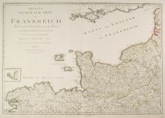 FRANKREICH. - Karte. - Neueste Generalkarte von Frankreich. Nach den bessten bisher bekantgemachten Karten und nach den in Frankreich gemessenen Triangeln. 6-teilige Gesamtkarte von Frankreich.
6 Kupferstiche von Cassini de Thury, neu herausgegeben von F.A. Schraembl, dat. 1789, je 51,5 x 74,5 cm.
Sehr detaillierte, nicht zusammengesetzte, Gesamtkarte von Frankreich. - Mit zartem Grenzkolorit. (Artikelnr. 2412GG)
Erfahren Sie mehr650,00 € Inkl. MwSt. -
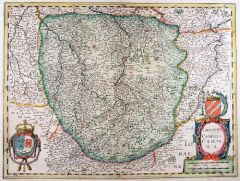 CHAMPAGNE. - Karte. - Champagne. Comitatus Campania.
Altkol. Kupferstich von Mercator, um 1650, 57 x 48 cm.
Flächenkolorierte Gesamtkarte der Champagne. Altkolorierte Rollwerkkartusche mit Wappen rechts unten, sowie ein weiteres altkoloriertes Wappen links unten. (Artikelnr. 18018BG)
Erfahren Sie mehr220,00 € Inkl. MwSt. -
ELSASS. - Karte. - Argentoratensis agri descriptio.
Kupferstich nach Daniel Speckel bei Ortelius, um 1580, 30 x 24 cm.
Zeigt das ganze Elass mit dem Rheinlauf von Rheinau bis Drusenheim. Mit Rollwerkskartusche links oben. (Artikelnr. 22808CG)
Erfahren Sie mehr140,00 € Inkl. MwSt. -
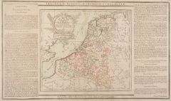 BELGIEN. - Karte. - Gesamtkarte mit Luxemburg.
Altkol. Kupferstich von Brion de la Tour, 1790, 23 x 26 cm, mit Legende 28 x 48 cm.
Beidseitig montierte Legende, die geographische, statistische und historische Besonderheiten beschreibt. (Artikelnr. 7668AG)
Erfahren Sie mehr70,00 € Inkl. MwSt. -
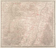 STRASSBURG. - Karte. - Strassburg. Zweybrücken. Freiburg.
Lithographie nach I. E. Woerl bei Herder, dat. 1834, 38,5 x 44,5 cm.
Zeigt den Rheinlauf zwischen Königsschaffhausen und Schwarzach. Die Strassen und Eisenbahnlinien in Rot gedruckt. (Artikelnr. 13577CG)
Erfahren Sie mehr170,00 € Inkl. MwSt. -
SCHWEIZ. - Karte. - Die Schweiz. Gesamtkarte.
Farblithographie nach Wolf aus Spamer, 1902, 31,5 x 41,5 cm.
Espenhorst, PP 23.2. - Aus: O. Spamer's "Grosser Hand-Atlas" (2. Ausgabe, Auflage 1902). - Verso Typographie, mit 12 Gebietskarten. (Artikelnr. 35087EG)
Erfahren Sie mehr90,00 € Inkl. MwSt. -
SKANDINAVIEN. - Karte. - Schweden und Norwegen.
Farblithographie aus Sohr-Berghaus bei Flemming, Glogau, um 1885, 40,5 x 33 cm.
Espenhorst, PP 4.1.3. - Aus: Sohr-Berghaus's "Hand-Atlas über alle Teile der Erde". - Mit einer Nebenkarte von Stockholm. (Artikelnr. 19482BG)
Erfahren Sie mehr80,00 € Inkl. MwSt. -
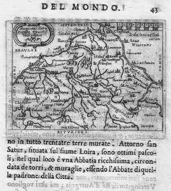
VERMANDOIS/Savoyen. - Karte. - Veromaduorum eorum que confinium. Gesamtkarte.
Kupferstich bei Botero, um 1590, 7,5 x 10,5 cm (auf der vollen Buchseite). (Artikelnr. 16387CG)
Erfahren Sie mehr48,00 € Inkl. MwSt. -
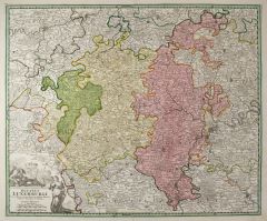 LUXEMBURG. - Karte. - Ducatus Luxemburg.
Altkol. Kupferstich von J.B. Homann, um 1735, 48 x 58 cm.
Gesamtkarte von der Maas zwischen Namur, Sedan und Villefranche im Westen und Schleyden, Budelich, Mursen sowie Trier und Saarlouis im Osten. Mit großer allegorischer Titelkartusch... (Artikelnr. 24781CG)
Erfahren Sie mehr300,00 € Inkl. MwSt. -
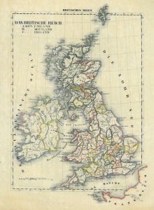
GROSSBRITANNIEN. - England. - Karte. - England.
Grenzkol. Kupferstich nach Kiepert, Weimar im Geograph. Institut, 1876, 63 x 51 cm.
Espenhorst, AS, 1.1.6. - Zeigt im Norden Glasgow und Edinburgh, im Westen das östliche Irland. Mit Nebenkarte "London mit seinen nächsten Umgebungen". Mi... (Artikelnr. 32613EG)
Erfahren Sie mehr88,00 € Inkl. MwSt. -
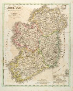
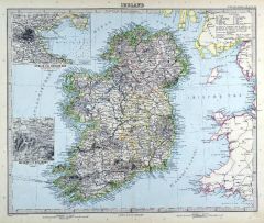 IRLAND. - Karte. - Ireland. Gesamtkarte.
Kupferstich mit Farblithographie nach Petermann aus Stieler bei Perthes, Gotha, 1891, 33 x 40 cm.
Espenhorst, PP 2.1.1.1.8. - Aus: A. Stieler's "Hand-Atlas" (8. Ausgabe, Auflage 1891). - Mit 2 Nebenkarten "Die See'n von Killarney" und "Dub... (Artikelnr. 19174BG)
Erfahren Sie mehr90,00 € Inkl. MwSt. -
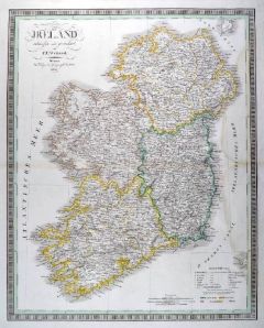 IRLAND. - Karte. - Ireland. Gesamtkarte.
Grenzkol. Kupferstich nach Weiland, Weimar im Geograph. Institut, dat. 1837, 60 x 48,5 cm.
Espenhorst, PP 1.1.3. - Mit Farberklärungen für die Provinzen Leinster, Ulster, Connaught und Munster. - Rechts wasserrandig bis in die Darstellun... (Artikelnr. 662FG)
Erfahren Sie mehr138,00 € Inkl. MwSt. -
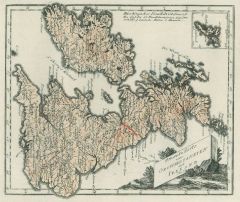
 IRLAND. - Karte. - Ireland. Gesamtkarte.
Grenzkol. Kupferstich nach Weiland, Weimar im Geograph. Institut, dat. 1828, 38,5 x 31,5 cm.
Espenhost, PP 1.2.2. - Aus dem verkleinerten "Hand-Atlas ... für Bürgerschulen und Zeitungsleser" (sog. Bund-Ausgabe). - Seltener ("greater rari... (Artikelnr. 33304EG)
Erfahren Sie mehr95,00 € Inkl. MwSt. -
ITALIEN. - Karte. - Italien. Gesamtkarte.
Grenzkol. Kupferstich von Reyher und Seitz aus Kiepert bei Reimer, Berlin, 1858, 55 x 43,5 cm.
Espenhorst, PP 20.1.1. - Aus: Heinrich Kiepert's "Neuer Handatlas über alle Theile der Erde" (Ausgabe 1858). - Mit einer Insetkarte "Umgebungen... (Artikelnr. 19163BG)
Erfahren Sie mehr90,00 € Inkl. MwSt. -
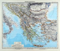 GRIECHENLAND. - Karte. - Balkan-Halbinsel.
Kupferstich mit Farblithographie von Lüddecke nach Vogel aus Stieler bei Perthes, Gotha, 1891, 33 x 40 cm.
Espenhorst, PP 2.1.1.1.8. - Aus: A. Stieler's "Hand-Atlas" (8. Ausgabe, Auflage 1891). - Zeigt Griechenland mit Kreta, sowie Bosnie... (Artikelnr. 19184BG)
Erfahren Sie mehr90,00 € Inkl. MwSt. -
STEIERMARK. - Karte. - Kronland Steyermark.
Grenz- und flächenkol. Lithographie von Kunsch nach Handtke aus Sohr bei Flemming, Glogau, 1853, 37 x 32,5 cm.
Espenhorst, PP 4.1.1. - Aus: Karl Sohr's "Vollständiger Universal=Handatlas der neueren Erdbeschreibung". - Mit Angabe der pol... (Artikelnr. 608FG)
Erfahren Sie mehr140,00 € Inkl. MwSt. -
GROSSBRITANNIEN. - Karte. - Grossbritannien und Ireland. Gesamtkarte.
Farblithographie aus Sohr-Berghaus bei Flemming, Glogau, um 1885, 40 x 33 cm.
Espenhorst, PP 4.1.3. - Aus: Sohr-Berghaus's "Hand-Atlas über alle Teile der Erde". (Artikelnr. 19474BG)
Erfahren Sie mehr75,00 € Inkl. MwSt. -
RUSSLAND. - Asiatischer Teil. - Karte. - Asiatisches Russland.
Farblithographie aus Sohr-Berghaus bei Flemming, Glogau, um 1885, 33 x 40,5 cm.
Espenhorst, PP 4.1.3. - Aus: Sohr-Berghaus's "Hand-Atlas über alle Teile der Erde". (Artikelnr. 19488BG)
Erfahren Sie mehr80,00 € Inkl. MwSt. -
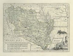
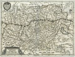 NIEDERÖSTERREICH. - Karte. - Archiducatus Austriae. Unter Österreich.
Kupferstich von M. Merian, 1649, 28,5 x 37,5 cm.
Gesamtkarte mit der Donau von Mauthausen bis Pressburg. Mit Viertel ob- und unter Wiener Wald. Wappenkartusche. (Artikelnr. 17230AG)
Erfahren Sie mehr160,00 € Inkl. MwSt. -
SKANDINAVIEN. - Karte. - Südliches Schweden und Norwegen.
Farblithographie aus Sohr-Berghaus bei Flemming, Glogau, um 1885, 40,5 x 33 cm.
Espenhorst, PP 4.1.3. - Aus: Sohr-Berghaus's "Hand-Atlas über alle Teile der Erde". (Artikelnr. 19483BG)
Erfahren Sie mehr75,00 € Inkl. MwSt. -
FRANKREICH. - Karte. - France par Départements. Mit Korsika.
Altkol. Kupferstich von Lemercier bei Furne, Paris, um 1865, 34 x 42,5 cm.
Aus "Atlas de Géographie Militaire". (Artikelnr. 34775EG)
Erfahren Sie mehr80,00 € Inkl. MwSt. -
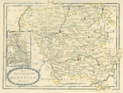
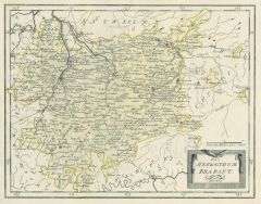 BRABANT. - Karte. - Das Herzogthum Brabant Nr. 179.
Grenzkol. Kupferstich von Reilly, um 1790, 26 x 34 cm.
Von Mecheln, Brüssel bis Tongeren und Namur. (Artikelnr. 6488AG)
Erfahren Sie mehr60,00 € Inkl. MwSt. -
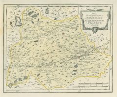
 HENNEGAU. - Karte. - Die Grafschaft Hennegau Nro. 173.
Grenzkol. Kupferstich von Reilly, um 1790, 23,5 x 30,5 cm.
Zeigt das Gebiet zwischen Grammont, Conde, Merbes, Nivelle. (Artikelnr. 17769AG)
Erfahren Sie mehr60,00 € Inkl. MwSt. -
 60,00 € Inkl. MwSt.
 -
 110,00 € Inkl. MwSt.
 -
70,00 € Inkl. MwSt.
-
FRANKREICH. - Karte. - Frankreich, Politische Übersicht.
Farblithographie nach Wolf aus Spamer, 1902, 31,5 x 41,5 cm.
Espenhorst, PP 23.2. - Aus: O. Spamer's "Grosser Hand-Atlas" (2. Ausgabe, Auflage 1902). - Verso Typographie, mit 6 Gebietskarten. (Artikelnr. 35093EG)
Erfahren Sie mehr70,00 € Inkl. MwSt.