Suchergebnisse für: "europa karte"
-
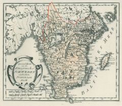 SCHWEDEN. - Karte. - Spezialkarte von des Königreichs Schweden südlichen Provinzen Nro. 68.
Grenzkol. Kupferstich von Reilly, um 1790, 22,5 x 27 cm.
Gebiet des seenreichen Götalands mit Vänersee und Vättersee, einschließlich Gotland und Öland bis Värmland im Norden. (Artikelnr. 17731AG)
Erfahren Sie mehr90,00 € Inkl. MwSt. -
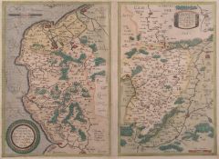 CALAIS. - Karte. - Vom Land der Caleten und Bononienser.
Altkol. Kupferstich von Ortelius nach Johann Surhorn, 1579, 34 x 24 cm.
Zeigt das Gebiet zwischen Calais, Boulogne, Etaples und Montreuil. Rechts Nebenkarte (34 x 21 cm) "Veromandui" mit dem Gebiet zwischen Cambrai, St. Quentin und der Ois... (Artikelnr. 17058AG)
Erfahren Sie mehr140,00 € Inkl. MwSt. -
FRANKREICH. - Südfrankreich. - Karte. - Frankreich. Südliche Hälfte. Mit Nebenkarte.
Farblithographie nach Scrobel aus Andree bei Velhagen & Klasing, 1900, 36,5 x 45,5 cm.
Espenhorst, PP 5.1.4. - Aus: Richard Andree's "Allgemeiner Handatlas" (4. Ausgabe, Auflage 1900). - Zeigt im Norden das Gebiet ab der Linie Poitier-Moul... (Artikelnr. 728FG)
Erfahren Sie mehr100,00 € Inkl. MwSt. -
RUSSLAND. - Karte. - Das Europaeische Russland, bis zum Ural.
Grenzkol. Kupferstich nach Weiland, Weimar im Geograph. Institut, dat. 1829, 39 x 31 cm.
Espenhost, PP 1.2.2. - Aus dem verkleinerten "Hand-Atlas ... für Bürgerschulen und Zeitungsleser" (sog. Bund-Ausgabe). - Seltener ("greater rarity")... (Artikelnr. 33309EG)
Erfahren Sie mehr130,00 € Inkl. MwSt. -
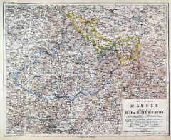
MÄHREN. - Karte. - Die Markgrafschaft Mähren nebst Oesterreichisch Schlesien.
Grenzkol. Kupferstich nach Weiland, Weimar im Geograph. Institut, dat. 1830, 27 x 37,5 cm.
Espenhost, PP 1.2.2. - Aus dem verkleinerten "Hand-Atlas ... für Bürgerschulen und Zeitungsleser" (sog. Bund-Ausgabe). - Seltener ("greater rarity... (Artikelnr. 33284EG)
Erfahren Sie mehr85,00 € Inkl. MwSt. -
FRANKREICH. - Karte. - Frankreich. Gesamtkarte, mit Nebenkarte Korsika und Umgebungsplan von Paris.
Grenzkol. Kupferstich nach Weiland, Weimar im Geograph. Institut, dat. 1855/57, 61 x 53,5 cm.
Espenhorst, PP 1.1.5. - Mit grenzkol. Einteilung nach Departements. "Eisenbahnen nachgetragen 1857". (Artikelnr. 33153EG)
Erfahren Sie mehr128,00 € Inkl. MwSt. -
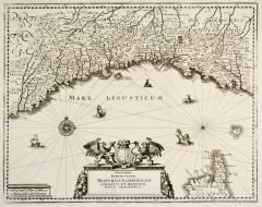
 VENEDIG. - Karte. - Dominii Veneti cum vivinis Parmae Mutinae, Mantuae et Mirandolae.
Altkol. Kupferstich von J.B. Homann, um 1720, 49 x 58 cm.
Zeigt das Gebiet von Bergamo bis zum Golf von Triest. Mit großer, figürlicher Kartusche rechts unten. (Artikelnr. 9586CG)
Erfahren Sie mehr280,00 € Inkl. MwSt. -
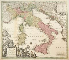 ITALIEN. - Karte. - Nova totius Italiae cum adjacentibus Majoribus et Minoribus Insulis.
Altkol. Kupferstich von M. Seutter, um 1740, 49 x 57 cm.
Gesamtkarte mit Korsika, Sardinien, Sizilien und der kroatischen Küste. Mit großer figürlicher Kartusche. - Leicht gebräunt. (Artikelnr. 24650CG)
Erfahren Sie mehr320,00 € Inkl. MwSt. -
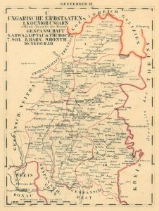
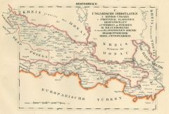
ÖSTERREICH und UNGARN. - Karte. - Österreich-Ungarn, Politische Übersicht. Gesamtkarte der Monarchie.
Farblithographie nach Wolf aus Spamer, 1902, 31,5 x 41,5 cm.
Espenhorst, PP 23.2. - Aus: O. Spamer's "Grosser Hand-Atlas" (2. Ausgabe, Auflage 1902). - Verso Typographie, mit 8 Gebietskarten. (Artikelnr. 35083EG)
Erfahren Sie mehr95,00 € Inkl. MwSt. -
BÖHMEN. - Karte. - Das Königreich Böhmen. Mit zwei Umgebungskarten: Teplitz und Prag.
Grenzkol. Kupferstich von Jungmann nach Weiland, Weimar im Geograph. Institut, dat. 1838, 46,5 x 59 cm.
Espenhorst, PP 1.1.3. - Unten schwach wasserrandig bis in die Darstellung. (Artikelnr. 634FG)
Erfahren Sie mehr122,00 € Inkl. MwSt. -
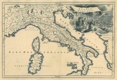 ITALIEN. - Karte. - Italia medii aevi. Gesamtkarte mit Korsika und Sardinien im Mittelalter.
Kupferstich von J.G. Beck, 1773, 20,5 x 30,5 cm.
Aus: Christoph Cellarius, "Notitia orbis antiquii sive geographia plenior". - Mit figürlicher Kartusche. (Artikelnr. 19288CG)
Erfahren Sie mehr95,00 € Inkl. MwSt. -
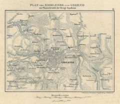 SMOLENSK. - Karte. - Plan von Smolensk und Gegend zur Characteristik der Kriege Napoleons.
Lithographie bei Herder, Freiburg, um 1840, 14 x 18,5 cm.
Umgebungskarte bis Nastasino, Tutaiewa, Popowa, Surgokowa und Mujalowo. - Insgesamt etwas sstockfleckig. (Artikelnr. 17331AG)
Erfahren Sie mehr28,00 € Inkl. MwSt. -
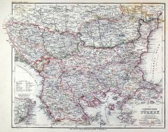
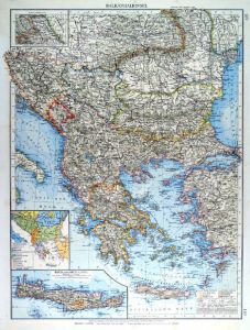 BALKAN. - Karte. - Balkanhalbinsel. Mit zwei Nebenkarten.
Farblithographie nach Scrobel aus Andree bei Velhagen & Klasing, 1900, 49 x 37 cm.
Espenhorst, PP 5.1.4. - Aus: Richard Andree's "Allgemeiner Handatlas" (4. Ausgabe, Auflage 1899). - "Mit dieser Ausgabe wurde der ANDREE zum führenden deut... (Artikelnr. 35026EG)
Erfahren Sie mehr120,00 € Inkl. MwSt. -
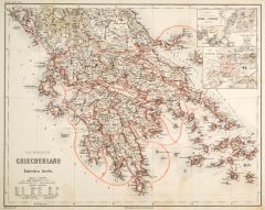
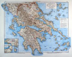 GRIECHENLAND. - Karte. - Griechenland. Mit vier Nebenkarten.
Farblithographie von Wagner nach Ambrosius aus Andree bei Velhagen & Klasing, 1899, 38,5 x 49,5 cm.
Espenhorst, PP 5.1.4. - Aus: Richard Andree's "Allgemeiner Handatlas" (4. Ausgabe, Auflage 1899). - "Mit dieser Ausgabe wurde der ANDREE zu... (Artikelnr. 35025EG)
Erfahren Sie mehr130,00 € Inkl. MwSt. -
 BORDEAUX. - Karte. - Tabula Aquitaniae complectens gubernationem Guennae et Vasconiae
Altkol. Kupferstich von Johann Baptist Homann, um 1720, 56 x 46 cm.
Zeigt das Gebiet um Bordeaux bis Oleron im Süden und Cahors im Osten. Mit großer figürlicher Titelkartusche links oben, einer Kartusche mit Gesamtansicht von Bordeaux u... (Artikelnr. 27119CG)
Erfahren Sie mehr280,00 € Inkl. MwSt. -
NIEDERLANDE. - Benelux. - Karte. - Niederlande und Belgien. Gesamtkarte der Beneluxstaaten.
Grenzkol. Kupferstich von Herzberg und Sporer aus Kiepert bei Reimer, Berlin, 1858, 55 x 43,5 cm.
Espenhorst, PP 20.1.1. - Aus: Heinrich Kiepert's "Neuer Handatlas über alle Theile der Erde" (Ausgabe 1858). - In den Rändern minimal fleck... (Artikelnr. 19026BG)
Erfahren Sie mehr80,00 € Inkl. MwSt. -
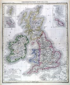
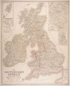 GROSSBRITANNIEN. - Karte. - Die Britischen Inseln. Gesamtkarte mit 4 Nebenkarten.
Grenzkol. Kupferstich von Kratz nach Kiepert und Gräf, Weimar im Geograph. Institut, dat. 1859, 60 x 49 cm.
Espenhorst, PP 1.1.5. - Aus: Kiepert, "Hand-Atlas", 42. Ausgabe (1856/69). - Die Nebenkarten zeigen: Die Shetland-Inseln, Normann... (Artikelnr. 14970AG)
Erfahren Sie mehr95,00 € Inkl. MwSt. -
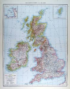 GROSSBRITANNIEN. - Karte. - Grossbritannien und Irland. Gesamtkarte der Britischen Inseln.
Farblithographie aus Andree bei Velhagen & Klasing, 1881, 46,5 x 36,5 cm.
Espenhorst, PP 5.1.1. - Aus: Richard Andree's "Allgemeiner Handatlas" (1. Ausgabe, Auflage 1881). - Verso 5 weitere Darstellungen: "Niederlande" im Süden bis Luxemb... (Artikelnr. 35336EG)
Erfahren Sie mehr85,00 € Inkl. MwSt. -
 GROSSBRITANNIEN. - Karte. - Grossbritannien und Irland. Gesamtkarte der britischen Inseln.
Grenzkol. Kupferstich von Herzberg nach Heck aus Stein bei Hinrichs, 1857, 48 x 40 cm.
Espenhorst, PP 31.1.1.2. - Aus: C.G.D. Stein "Neuer Atlas der ganzen Erde" (29. Ausgabe, Auflage 1857). - Mit vier Nebenkarten: "Shetländischer Archipe... (Artikelnr. 34921EG)
Erfahren Sie mehr90,00 € Inkl. MwSt. -
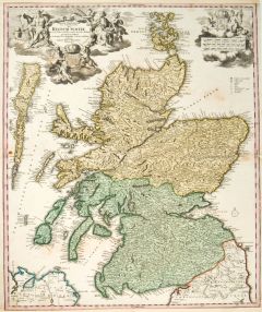 SCHOTTLAND. - Karte. - Magnae Britanniae pars Septentionalis qua Regnum Scotiae.
Altkol. Kupferstich von J.B. Homann, um 1730, 57 x 48 cm.
Gesamtkarte mit Nord- und Südschottland, den Orkneyinseln im Norden und den westlich vorgelagerten Inselgruppen. Mit großer figürlicher Kartusche links oben und kleinerer Wappenk... (Artikelnr. 10106CG)
Erfahren Sie mehr250,00 € Inkl. MwSt. -
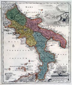 ITALIEN. - Süditalien. - Karte. - Typus Regni Neapolitania in suas provincias.
Altkol. Kupferstich bei Chr. Weigel, 1718, 39 x 33 cm.
Aus: Johann David Köhlers "Bequemer Schul= und Reisen=Atlas", 1718. - Zeigt Italien südlich des Kirchenstaates mit den Liparischen Inseln und der Südspitze von Sizilien. Rechts unte... (Artikelnr. 18648BG)
Erfahren Sie mehr280,00 € Inkl. MwSt. -
 GRIECHENLAND. - Karte. - Das Königreich Griechenland mit den Ionischen Inseln.
Stahlstich mit Farblithographie nach Ravenstein aus Meyer bei BI, um 1865, 33 x 42 cm.
Espenhorst, PP 3.4 (Meyer-Ravenstein 1862-1884). - Aus: Joseph Meyer's "Hand-Atlas", redigiert von Ludwig Ravenstein (1838-1915). - Mit zwei Nebenkarten... (Artikelnr. 19257BG)
Erfahren Sie mehr120,00 € Inkl. MwSt. -
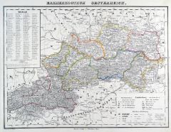 ÖSTERREICH. - Karte. - Erzherzogthum Österreich, ob und unter der Enns.
Grenzkol. Lithographie nach Theinert aus Sohr bei Flemming, Glogau, um 1850, 30 x 40 cm.
Espenhorst, PP 4.1.1. - Aus: Karl Sohr's "Vollständiger Universal=Handatlas der neueren Erdbeschreibung". - Mit 151 numerierten Bergen. - Insgesamt l... (Artikelnr. 35233EG)
Erfahren Sie mehr90,00 € Inkl. MwSt. -
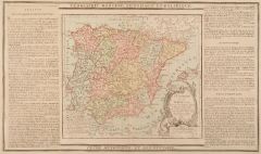
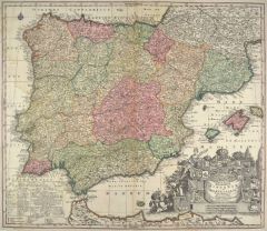 SPANIEN. - Karte. - Novissima et accurat. regnorum Hispaniae et Portugalliae.
Altkol. Kupferstich von Matthäus Seutter, um 1730, 50 x 57,5 cm.
Die schöne Gesamtkarte der iberischen Halbinsel zeigt auch die Balearen sowie die Nordküste Afrikas. Große figürliche Kartusche mit zahlreichen Wappen rechts unten. - Vo... (Artikelnr. 23434CG)
Erfahren Sie mehr320,00 € Inkl. MwSt. -
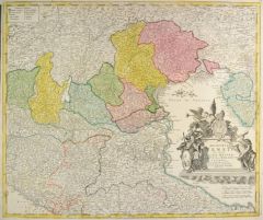
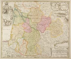
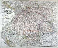 UNGARN. - Karte. - Ungarn mit seinen Nebenländern und Galizien. Gesamtkarte.
Grenzkol. Kupferstich von Eulenstein nach Gräf und Kiepert, Weimar im Geograph. Institut, dat. 1857, 52 x 64 cm.
Espenhorst, PP 1.1.5. - Mit Nebenkarte oben links: "Südliches Dalmatien im Anschluß an den unteren Rand der Hauptkarte". Mi... (Artikelnr. 33135EG)
Erfahren Sie mehr130,00 € Inkl. MwSt. -
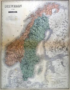 SKANDINAVIEN. - Karte. - Schweden und Norwegen. Mit Finnland und Dänemark.
Farblithographie nach Gräf, Weimar im Geograph. Institut, 1885, 47,5 x 58 cm.
Espenhorst, PP 1.1.6. - Aus: Heinrich Kiepert's "Grosser Handatlas" (49. Ausgabe, Auflage 1885). - Im Süden die deutsche Ostseeküste, im Osten St. Petersburg.... (Artikelnr. 35277EG)
Erfahren Sie mehr90,00 € Inkl. MwSt. -
SKANDINAVIEN. - Karte. - Schweden und Norwegen. Südlicher Teil, mit Dänemark.
Farblithographie nach Scrobel aus Andree bei Velhagen & Klasing, 1900, 37,5 x 49,50 cm.
Espenhorst, PP 5.1.4. - Aus: Richard Andree's "Allgemeiner Handatlas" (4. Ausgabe, Auflage 1900). - Zeigt das Gebiet ab dem Sogne und der Linie Fulu-S?... (Artikelnr. 736FG)
Erfahren Sie mehr100,00 € Inkl. MwSt. -
 JUGOSLAWIEN. - Karte. - Provinzial Slavonien. Gespanschaft Veroecz, Syrmien. Militärgrenze: Slavonische Grenze, Regimentsbezirk, Brod u. Peterwardein.
Grenzkol. Lithographie bei Schlieben, 1829, 19 x 26 cm.
Gebietskarte zwischen Drau und Save. (Artikelnr. 18753AG)
Erfahren Sie mehr65,00 € Inkl. MwSt. -
 BALKAN. - Karte. - Die europaeische Türkey. Zeigt die Balkanhalbinsel ohne Griechenland.
Grenzkol. Stahlstich nach Ravenstein aus Meyer bei BI, um 1865, 28,5 x 35,5 cm.
Espenhorst, PP 3.4 (Meyer-Ravenstein 1862-1884). - Aus: Joseph Meyer's "Hand-Atlas", redigiert von Ludwig Ravenstein (1838-1915). - Mit einer kleinen Nebenkart... (Artikelnr. 19332BG)
Erfahren Sie mehr120,00 € Inkl. MwSt. -
 NEUCHATEL. - Karte. - Carte des comtés de Neuchatel et de Vallangin.
Kupferstich von Perrier nach Beauvais aus "Zurlauben", 1780, 34 x 44 cm.
Umgebungskarte zwischen Doubs und Baume im Westen und Sonvillier und Berner See im Osten, im Norden der Neuchateler See. - Mit Titelkartusche. (Artikelnr. 15216AG)
Erfahren Sie mehr160,00 € Inkl. MwSt. -
SCHWEIZ. - Karte. - Die Schweiz. Gesamtkarte. Mit 140 Höhenangaben im Unterrand.
Grenzkol. Lithographie von Müller nach Handke aus Sohr bei Flemming, Glogau, um 1850, 27 x 37,5 cm.
Espenhorst, PP 4.1.1. - Aus: Karl Sohr's "Vollständiger Universal=Handatlas der neueren Erdbeschreibung". - Insgesamt stärker fleckig, w... (Artikelnr. 35231EG)
Erfahren Sie mehr70,00 € Inkl. MwSt. -
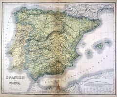 SPANIEN und PORTUGAL. - Karte. - Spanien und Portugal. Gesamtkarte, mit Balearen.
Kupferstich mit Farblithographie nach Kiepert, Weimar im Geograph. Institut, 1886, 53 x 66 cm.
Espenhorst, PP 1.1.6. - Aus: Heinrich Kiepert's "Grosser Hand-Atlas" (49. Ausgabe, Auflage 1886). - Zeigt im Süden die nordafrikanische Küste.... (Artikelnr. 35164EG)
Erfahren Sie mehr100,00 € Inkl. MwSt. -
 MÄHREN. - Karte. - Markgrafschaft Mähren und Herzogthum Ober und Nieder-Schlesien.
Stahlstich mit Farblithographie nach Ravenstein aus Meyer bei BI, um 1865, 34,5 x 43 cm.
Espenhorst, PP 3.4 (Meyer-Ravenstein 1862-1884). - Aus: Joseph Meyer's "Hand-Atlas", redigiert von Ludwig Ravenstein (1838-1915). - Mit zwei kleinen L... (Artikelnr. 19306BG)
Erfahren Sie mehr110,00 € Inkl. MwSt. -
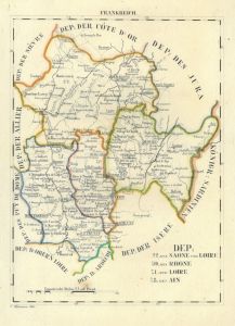 CHAROLAIS. - Karte. - Dep: der Saone und Loire, des Tjone, der Loire, des Ain.
Grenzkol. Lithographie von Hermann bei Schlieben, 1829, 26 x 19 cm.
Gebietskarte von Beaujolais und Charolais. (Artikelnr. 18743AG)
Erfahren Sie mehr62,00 € Inkl. MwSt. -
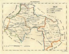 TOURRAINE. - Karte. - Dep: der Indre und Loire, des Loir und Cher, des Cher.
Grenzkol. Lithographie von Hermann bei Schlieben, 1829, 19 x 26 cm.
Gebietskarte mit Tour und Bourges im Mittelgrund. (Artikelnr. 18726AG)
Erfahren Sie mehr62,00 € Inkl. MwSt. -
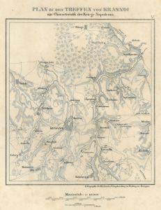 KRASNOJE. - Karte. - Plan zu den Treffen von Krassnoi zur Characteristik der Kriege Napoleons.
Lithographie bei Herder, Freiburg, um 1840, 16 x 14 cm.
Umgebungskarte bis Nitiage, Siniaki, Sidorowiezi, Smilowa. - Gering stockfleckig. (Artikelnr. 17333AG)
Erfahren Sie mehr28,00 € Inkl. MwSt. -
FRANKREICH. - Karte. - Charte von Frankreich. In den Ecken Inschrift und Erklärungen.
Grenzkol. Kupferstich nach C.F. Weiland beim Geogr. Inst. Weimar, 1826, 59 x 61 cm.
Mit Einteilung nach Departements und Militärbezirken. - In den Rändern leicht knittrig und mit hinterlegten Randeinrissen. (Artikelnr. 32573EG)
Erfahren Sie mehr125,00 € Inkl. MwSt. -
NIEDERLANDE. - Benelux. - Karte. - Niederlande und Belgien. Mit Nebenkarte "Neue Festung Antwerpen".
Grenzkol. Kupferstich nach Vogel aus Stieler bei Perthes, Gotha, 1866, 41 x 32,5 cm.
Espenhorst, PP 2.1.1.1.4. - Aus: A. Stieler's "Hand-Atlas" (4. Ausgabe, Auflage 1866). - Mittelbug verso verstärkt. (Artikelnr. 34901EG)
Erfahren Sie mehr70,00 € Inkl. MwSt. -
 GENUA. - Karte. - Genovesato Serenissimae Reipublicae Genuensis ducatus et dominii nova descriptio.
Kupferstich von Merian aus "Theatrum Europaeum", 1734, 30,5 x 38 cm.
Gebietskarte der Mittelmeerküste von Genua bis Nizza im Westen und La Spezia im Osten sowie Korsika. Mit Wappenkartusche. (Artikelnr. 18855CG)
Erfahren Sie mehr142,00 € Inkl. MwSt. -
 SPANIEN und PORTUGAL. - Karte. - L'Espagne et le Portugal. Gesamtkarte mit Gibraltar.
Altkol. Kupferstich von Brion de la Tour, 1790, 23 x 26 cm, mit Legende 28 x 48 cm.
Beidseitig montierte Legende, die geographische, statistische und historische Besonderheiten beschreibt. - Mit Kartusche. (Artikelnr. 7687AG)
Erfahren Sie mehr70,00 € Inkl. MwSt. -
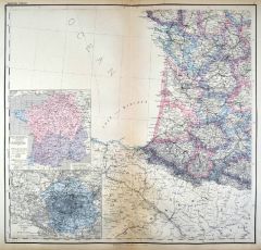 FRANKREICH. - Südfrankreich. - Karte. - Südwestliches Frankreich. Mit zwei Nebenkarten.
Kupferstich mit Farblithographie nach Kiepert, Weimar im Geograph. Institut, 1886, 54,5 x 57,5 cm.
Espenhorst, PP 1.1.6. - Aus: Heinrich Kiepert's "Grosser Hand-Atlas" (49. Ausgabe, Auflage 1886). - Zeigt die Küste von Les Sables d'Olonn ... (Artikelnr. 35162EG)
Erfahren Sie mehr90,00 € Inkl. MwSt. -
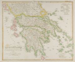 GRIECHENLAND. - Karte. - Griechenland mit Beachtung der Klassischen Zeit.
Grenzkol. Kupferstich von Hase aus Stieler bei Perthes, Gotha, dat. 1831, 31 x 37,5 cm.
Espenhorst, PP 2.1.1.1.0.b. - Aus: A. Stieler's "Hand-Atlas" ("Initial Version Expanded through Supplements"). - Mit Grenzkolorit für die "erste/ zwei... (Artikelnr. 33221EG)
Erfahren Sie mehr95,00 € Inkl. MwSt. -
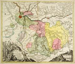 BASEL. - Karte. - Basileensis, qui pars est reipublicae Helvetiorum.
Altkol. Kupferstich von Matthäus Seutter bei J.M. Probst, Augsburg, nach 1762, 49 x 58 cm.
Gesuchte Kantonskarte mit großer figürlicher Kartusche links unten und einer weiteren Kartusche rechts unten mit Ansicht von Basel. - Rechts oben... (Artikelnr. 27323CG)
Erfahren Sie mehr750,00 € Inkl. MwSt. -
DÄNEMARK. - Inseln. - Karte. - Insulae Danicae in Mari Balthico sitae ... Zeelandia, Fionia, Langelandia.
Altkol. Kupferstich von Johann Baptist Homann, um 1720, 50 x 58 cm.
Schöne, flächenkolorierte Gesamtkarte der dänischen Inselwelt. Mit großer figürlicher Kartusche rechts unten. (Artikelnr. 27069CG)
Erfahren Sie mehr300,00 € Inkl. MwSt.