Suchergebnisse für: "europa karte"
-
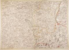
FRANKREICH. - Karte. - Galliae Antiquae Tabula In Septem Et Decem Provinciis. Frankreich und seine 17 römischen Provinzen, dazu Erklärungen.
Grenzkol. Kupferstich aus Delamarche, dat. 1833, 27 x 36 cm.
Aus: Felix Delamarche's "Atlas de la Géographie ancienne, du moyen-age et moderne". - Der Ingenieur und Mechaniker für Erd- und Himmelsgloben übernahm 1811 das Atlantengeschä... (Artikelnr. 34843EG)
Erfahren Sie mehr65,00 € Inkl. MwSt. -
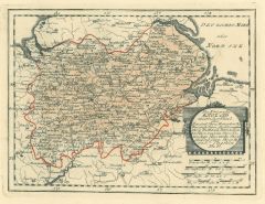
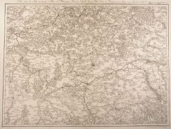
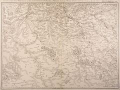
UNGARN. - Karte. - Die Kaiserl. Oesterreichischen Ungarischen Erbstaaten, das ist Ungarn, Siebenbürgen, Dalmatien und die Militair-Graenze. Mit Nebenkarte.
Grenzkol. Kupferstich nach Weiland, Weimar im Geograph. Institut, dat. 1836, 46 x 67 cm.
Espenhost, PP 1.2.2. - Aus dem verkleinerten "Hand-Atlas ... für Bürgerschulen und Zeitungsleser" (sog. Bund-Ausgabe). - Seltener ("greater rarity")... (Artikelnr. 33312EG)
Erfahren Sie mehr120,00 € Inkl. MwSt. -
 UKRAINE. - Karte. - Charte der Kriegs Operatione am Donn u. Dnieper Ihro Russisch Kayserl. Maiestaet Glorieusen Armeen A. 1736.
Altkol. Kupferstich von Matthäus Seutter, dat. 1736, 52 x 61 cm.
Flächenkolorierte Militärkarte mit ausführlichen Erklärungen seitlich und unten. Veranschaulicht die geostrategische Situation zu Beginn des Russisch-Österreichischen T... (Artikelnr. 2702GG)
Erfahren Sie mehr450,00 € Inkl. MwSt. -
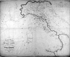
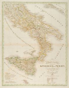 ITALIEN. - Süditalien. - Karte. - Unter-Italien enthaltend das Königreich beider Sicilien und die Insel Malta, mit Gozzo und Comino. Gebietskarte.
Grenzkol. Kupferstich von Kleinknecht nach Weiland, Weimar im Geograph. Institut, dat. 1828, 40 x 31 cm.
Espenhost, PP 1.2.2. - Aus dem verkleinerten "Hand-Atlas ... für Bürgerschulen und Zeitungsleser" (sog. Bund-Ausgabe). - Seltener ("... (Artikelnr. 33298EG)
Erfahren Sie mehr100,00 € Inkl. MwSt. -
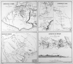 KRIM. - Sewastopol. - Karte. - Expédition de Crimée 1854. Die Umgebung von Sévastopol, im Südosten Balaklava. Mit drei weiteren Expeditionskarten.
Farblithographie von Erhard nach E. Bureau bei Lemercier bzw. Furne, Paris, um 1871, 18,5 x 22 cm (Krimkarte) bzw. 38 x 44 cm (Einfassungslinie).
Aus "Atlas de Géographie Militaire". - Dargestellt werden: Cochinchine Francaise Expedition ... (Artikelnr. 34796EG)
Erfahren Sie mehr70,00 € Inkl. MwSt. -
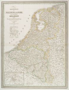 NIEDERLANDE. - Benelux. - Karte. - Das Königreich der Niederlande, das Königreich Belgien und das Grossherzogthum Luxemburg. Gesamtkarte der Beneluxstaaten, mit Plan von Amsterdam und Umgebung.
Grenzkol. Kupferstich nach Weiland, Weimar im Geograph. Institut, dat. 1842, 57,5 x 54 cm.
Espenhorst, PP 1.1.3. - Mit Farberklärungen. - Rechts gering wasserrandig. (Artikelnr. 663FG)
Erfahren Sie mehr120,00 € Inkl. MwSt. -
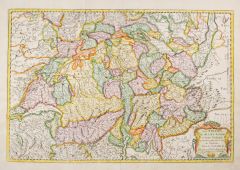 SCHWEIZ. - Karte. - Les Suisses, les Allies des Suißes et leurs Suiets; qui peuvent passer Sous le mon de Suisses. Partie de Souabe, &c.
Altkolorierter Kupferstich von R. Cordier nach N. Sanson, dat. 1667. 37 x 55 cm.
Schöne Gesamtkarte mit Einteilung der Kantone. - Die Ränder etwas angestaubt. (Artikelnr. 1104GG)
Erfahren Sie mehr350,00 € Inkl. MwSt. -
SPANIEN und PORTUGAL. - Karte. - Spanien und Portugal in 4 Blättern. Gesamtkarte in vier Teilen, mit Balearen und Nebenkarte (Umgebung von Madrid).
4 grenzkol. Kupferstiche von Weiler nach Vogel aus Stieler bei Perthes, Gotha, 1875, je 33 x 41 cm.
Espenhorst, PP 2.1.1.1.6. - Aus: A. Stieler's "Hand-Atlas" (6. Ausgabe, Auflage 1875). - Insgesamt 4 Darstellungen auf 4 Blättern. (Artikelnr. 34879EG)
Erfahren Sie mehr250,00 € Inkl. MwSt. -
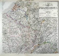 FRANKREICH. - Karte. - Nordöstliches Frankreich. Nordwestliches Frankreich. Südwestliches Frankreich. Südöstliches Frankreich. Gesamtkarte in vier Teilen, auf insgesamt vier Blättern.
4 grenzkol. Kupferstiche von Olmann und Eulenstein nach Gräf, Weimar im Geograph. Institut, dat.1858, je ca. 54 x 57,5 cm.
Espenhorst, PP 1.1.5. - Aus: Heinrich Kiepert's "Hand-Atlas" (42. Ausgabe, 1856/69). - Mit grenzkol. Einteilung nac... (Artikelnr. 35496EG)
Erfahren Sie mehr280,00 € Inkl. MwSt. -
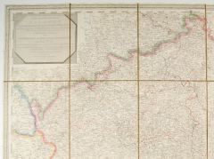
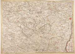
 FRANKREICH. - Karte. - Gebietskarte um Bourgogne, Champagne und Barrois. Umfasst das Gebiet zwischen Chateau-Vilain im Norden, Semür im Westen, im Süden Auxonne, Besancon und Chatillon.
Kupferstich von G. F. Abel bei W. Jaeger, um 1780, 47 x 62 cm.
Blatt 65 der "Carte Topographique d'Allemagne". (Artikelnr. 11863AG)
Erfahren Sie mehr142,00 € Inkl. MwSt. -
BÖHMEN. - Mähren und Schlesien. - Karte. - Mittel-Östliches Deutschland, enthält Preuss. Provinz Schlesien, dann Österreich. Kronländer Kgr. Böhmen, Markgrafschaft Mähren, Herzogth. Ober- u. Nieder-Schlesien.
Grenzkol. Kupferstich von Ausfeld aus Stieler bei Perthes, Gotha, dat. 1850, 28 x 34,5 cm.
Espenhorst, PP 2.1.1.1.2. - Aus: A. Stieler's "Hand-Atlas" ("Second Edition"). - Breitrandig. (Artikelnr. 33230EG)
Erfahren Sie mehr85,00 € Inkl. MwSt. -
FRANKREICH. - Karte. - La Gaule. Zeigt das antike Galllien zwischen Belgien und Aquitanien bzw. dem Rhein mit Köln und Narbonensis und Cisalpina.
Grenzkol. Kupferstich nach Delamarche und Robert de Vaugondy, Paris, dat. 1795, 24 x 28 cm.
Aus "Nouvel Atlas Portatif". - "An IIIe de la République Francaise." Oben die Südküste Englands mit London. - Im Rand rechts etwas knittrig. (Artikelnr. 32357EG)
Erfahren Sie mehr58,00 € Inkl. MwSt. -
ITALIEN. - Süditalien. - Karte. - Südliches Italien oder das Königreich beider Sicilien nebst den Inseln Malta, Gozzo u. Comino. Gebietskarte, mit Nebenkarte "Umgebungen von Neapel".
Grenzkol. Kupferstich von Kleinknecht nach Weiland, Weimar im Geograph. Institut, dat. 1841, 58 x 44 cm.
Espenhorst, PP 1.1.3. - Mit Farberklärungen. - Rechts wasserrandig bis knapp in die Darstellung. (Artikelnr. 656FG)
Erfahren Sie mehr122,00 € Inkl. MwSt. -
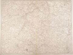
 BÖHMEN. - Karte. - Das Koenigreich Boehmen nach den neuesten astronomischen Orts-Bestimmungen mehreren Special-Aufnahmen und andern zuverläessigen Hülfs-Mitteln.
Grenzkol. Kupferstich nach Ferdinand Schmoll bei T. Mollo, Wien, dat. 1809, 92 x 120 cm (24 Segmente, je 22,5 x 20 cm). - In Pp.-Schuber d.Zt.
Die detaillierte Gesamtkarte von Böhmen in 24 Segmenten (je ca. 22,5 x 20 cm) auf Leinwand aufg... (Artikelnr. 1900GG)
Erfahren Sie mehr550,00 € Inkl. MwSt. -
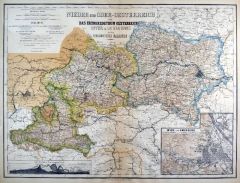
ÖSTERREICH. - Karte. - Süd-Östliches Deutschland enthält die Oesterreichischen Besitzungen. Gebietskarte mit Ober- und Niederösterreich, Tirol, Vorarlberg, Steiermark, Kärnten, Krain und dem Küstenland bis Carlopago.
Grenzkol. Kupferstich aus Stieler bei Perthes, Gotha, dat. 1822, 28,5 x 34 cm.
Espenhorst, PP 2.1.1.1.0.a (Teilabbildung S. 236, Illus. 2.45). - Aus: A. Stieler's "Hand-Atlas". ("Initial Version (Urausgabe)"). - Hinterlegter Eckeinriß. (Artikelnr. 33211EG)
Erfahren Sie mehr95,00 € Inkl. MwSt. -
FRANKREICH. - Karte. - Languedoc, Dauphiné, Provence. Gebietskarte, im Westen Toulouse, im Süden die Pyrenäen und die Mittelmeerküste bis Nizza, mit Einteilung in vierzehn Départements.
Grenzkol. Kupferstich von Dussy nach Delamarche und Robert de Vaugondy, Paris, um 1800, 24 x 28 cm.
Aus "Nouvel Atlas Portatif". - Zeigt im Norden Lyon, im Osten die Grenze zu Savoyen und Piemont. (Artikelnr. 32370EG)
Erfahren Sie mehr94,00 € Inkl. MwSt. -
 ÖSTERREICH. - Karte. - Nieder- und Ober-Oesterreich oder das Herzogthum Oesterreich Unter & Ob der Enns und das Herzogthum Salzburg. Mit Nebenkarte "Wien und Umgebung".
Kupferstich mit Farblithographie nach Gräf, Weimar im Geograph. Institut, 1886, 49 x 66 cm.
Espenhorst, PP 1.1.6. - Aus: Heinrich Kiepert's "Grosser Hand-Atlas" (49. Ausgabe, Auflage 1886). - Mit Höhenprofil: "Lundenburg-Wien-Sömmering-... (Artikelnr. 35152EG)
Erfahren Sie mehr90,00 € Inkl. MwSt. -
 ITALIEN. - Norditalien. - Karte. - Die Staaten von Oberitalien näml. das Lomb. Venet. Königreich Parma Modena Toscana, Lucca, St. Marino, u. d. Kirchenstaat 1850 mit Nebenkarte "Südl. Theil des Kirchenstaats".
Grenzkol. Stahlstich von Rothenburg aus Meyer's Zeitungsatlas, 1853, 24 x 20 cm. (Artikelnr. 413AG)
Erfahren Sie mehr60,00 € Inkl. MwSt. -
ITALIEN. - Karte. - Italien nach den besten Hilfsmitteln verfaßt. Mit Sardinien und Korsika, oben Inschrift, unten "Erklärung der Staaten" (I - X).
Grenzkol. Kupferstich bei T. Mollo, Wien, um1825, 44,5 x 32,5 cm.
Im Norden begrenzt durch Schweiz und Tirol, im Osten durch das ehemalige Jugoslawien bis zum Kanal von Otranto, im Süden durch Malta und das nördliche Tunesien, im Westen ... (Artikelnr. 605FG)
Erfahren Sie mehr150,00 € Inkl. MwSt. -
 ELSASS-LOTHRINGEN. - Karte. - Gebietskarte mit angrenzender Bourgogne und Schweiz. Zeigt das Gebiet zwischen Remiremont im Norden, Vesoul im Westen, Passavant im Norden und Rheinfelden im Osten.
Grenzkol. Kupferstich von D. A. Hauer bei W. Jaeger, um 1780, 47 x 62 cm.
Blatt 66 der "Carte Topographique d'Allemagne". (Artikelnr. 11866AG)
Erfahren Sie mehr190,00 € Inkl. MwSt. -
ITALIEN. - Karte. - Nouvelle carte de l'etat present de Italie etc. Gesamtkarte mit den Grenzen der dreizehn unabhängigen Herrschaftsgebiete, Nebenkarte mit Sizilien, seitlich dazu Erläuterungen.
Kupferstich von Chatelain, 1705, 33,5 x 66 cm.
Die Erläuterungen, "utile pour les voiages", mit alphabetischem Ortsverzeichnis, Verzeichnis der 39 Erbischofssitze, der 19 Universitäten, der Erdbebenorte von 1703 usw. - Drei Längsfalten... (Artikelnr. 31704EG)
Erfahren Sie mehr220,00 € Inkl. MwSt. -
 FRANKREICH. - Karte. - Zeigt das Gebiet zwischen Meaux, Laferte, Conde im Norden, im Westen Paris, Messe und Angerville, im Süden Sens, Villeuneuve, im Osten Troyes und Verfus.
Kupferstich von G. F. Abel nach J. G. Jaennicke bei W. Jaeger, um 1780, 47 x 62 cm.
Blatt 55 der "Carte Topographique d'Allemagne". (Artikelnr. 11879AG)
Erfahren Sie mehr114,00 € Inkl. MwSt. -
 ÖSTERREICH. - Karte. - Nieder- und Ober-Oesterreich oder das Herzogthum Oesterreich Unter & Ob der Enns und das Herzogthum Salzburg. Mit Nebenkarte "Wien und Umgebung".
Grenzkol. Kupferstich von Geyer und Kratz nach Gräf, Weimar im Geograph. Institut, 1872, 48,5 x 65 cm.
Espenhorst, PP 1.1.6. - Aus: Heinrich Kiepert's "Grosser Hand-Atlas" (43. Ausgabe, Auflage 1872). - Gewann 1871 die einzige Goldmedaill... (Artikelnr. 35452EG)
Erfahren Sie mehr130,00 € Inkl. MwSt. -
ÖSTERREICH. - Karte. - Süd-Östliches Deutschland, enthält die Oesterreichischen Kronländer usw. Gebietskarte mit Ober- und Niederösterreich, Tirol, Vorarlberg, Steiermark, Kärnten, Krain und dem Küstenland bis Carlopago.
Grenzkol. Kupferstich nach Stülpnagel aus Stieler bei Perthes, Gotha, dat. 1850, 28,5 x 34,5 cm.
Espenhorst, PP 2.1.1.1.2. (Teilabb. S. 237, Illus. 2.46.). - Aus: A. Stieler's "Hand-Atlas" ("Second Edition"). - Breitrandig, dort gering fl... (Artikelnr. 33231EG)
Erfahren Sie mehr95,00 € Inkl. MwSt. -
POLEN. - Karte. - Charte von dem Königreiche Polen, den Königl. Preussischen Provinzen Ost und West-Preussen und Posen nebst dem Gebiete der freien Stadt Krakau.
Grenzkol. Kupferstich nach Weiland, Weimar im Geograph. Institut, dat. 1830, 39,5 x 35 cm.
Espenhost, PP 1.2.2. - Aus dem verkleinerten "Hand-Atlas ... für Bürgerschulen und Zeitungsleser" (sog. Bund-Ausgabe). - Seltener ("greater rarity... (Artikelnr. 33310EG)
Erfahren Sie mehr120,00 € Inkl. MwSt. -
 POLEN. - Karte. - Der Königlichen Republik Polen Woiwodschaften Krakow u. Sandomir mit dem untern Theile der Woiwodschaft Lublin und dem Herzogthume Severien oder Klein Polens westlicher Theil. Nro. 42.
Grenzkol. Kupferstich von Reilly, um 1790, 21 x 28,5 cm.
Zeigt das Gebiet nördlich der Weichsel mit Krakau, Sandomir und Lublin bis Warschau. (Artikelnr. 24394CG)
Erfahren Sie mehr120,00 € Inkl. MwSt. -
KASPISCHES MEER. - Karte. - Bosporus Maeotis etc. Zeigt das Gebiet vom Schwarzen Meer mit Krim bis zum Kaspischen Meer mit Wolgamündung in der Antike (Skythen, Sarmaten).
Kupferstich nach Chr. Cellarius bei J.B. Ghisi, Rom, 1774, 30 x 45 cm.
T. XXIII aus: "Cellarius' Geographica Antiqua in Compendium Redacta". - Mit den heutigen Ländern Kasachstan, Kaukasien, Georgien, Armenien, Aserbeidschan usw. Titelkar... (Artikelnr. 30201EG)
Erfahren Sie mehr180,00 € Inkl. MwSt. -
 ELSASS-LOTHRINGEN. - Karte. - Gebietskarte von Elsass-Lothringen. Umfasst das Gebiet zwischen Lichtenberg und Morhange im Norden, im Westen Bayon und Charmes, im Süden Epinal und Neu-Breisach, im Osten Strassburg.
Grenzkol. Kupferstich von D. A. Hauer bei W. Jaeger, um 1780, 47 x 62 cm.
Blatt 57 der "Carte Topographique d'Allemagne". (Artikelnr. 11872AG)
Erfahren Sie mehr142,00 € Inkl. MwSt. -
 ITALIEN. - Karte. - Carta d'Italia con le Divisioni Politiche del Tempo di Dante. Gesamtkarte, mit Sizilien, Sardinien und Korsika. Italiens politische Einteilung zur Zeit Dantes.
Kupferstich auf Leinen von Balatri und Chirici nach Lord Vernon und Canstrini, Florenz, dat. 1847, 57,5 x 70 cm.
per servire di guida alla Divina Comedia - als Hilfsmittel zum Verständnis der Göttlichen Komödie. Der Dante-Enthusiast Lo... (Artikelnr. 35614EG)
Erfahren Sie mehr120,00 € Inkl. MwSt. -
ÖSTERREICH. - Karte. - Nieder- und Ober-Oesterreich oder das Herzogthum Oesterreich Unter & Ob der Enns und das Herzogthum Salzburg. Mit Nebenkarte von Wien und Umgebung.
Grenzkol. Kupferstich von Geyer und Kratz nach Gräf, Weimar im Geograph. Institut, 1872, 48,5 x 65 cm.
Espenhorst, PP 1.1.6. - Aus: Heinrich Kiepert's "Grosser Hand-Atlas" (43. Ausgabe, Auflage 1872). - Gewann 1871 die einzige Goldmedaill... (Artikelnr. 35513EG)
Erfahren Sie mehr120,00 € Inkl. MwSt. -
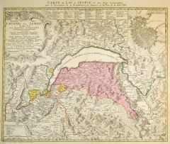 GENFER SEE. - Karte. - Carte du Lac de Geneve et des Pays circonvoisins avec le Territoire de la Republique de Geneve et du Plan de la ditte Ville.
Altkol. Kupferstich nach Rizzi-Zannoni bei Homann Erben, dat. 1766, 47,5 x 59 cm.
Zeigt das Gebiet um den Genfer See, oben gestochene Erklärungen 1 - 58, links große Titelkartusche und rechts oben Plan von Genf. (Artikelnr. 27278CG)
Erfahren Sie mehr300,00 € Inkl. MwSt. -
FRANKREICH. - Karte. - Berri, Nivernois, Bourbonois, Lyonois, Bourgogne, Bresse, et Franche-Comté. Gebietskarte von der Loire mit Blois bis zum Genfer See, mit Einteilung in zwölf Départements.
Grenzkol. Kupferstich von Dussy nach Delamarche und Robert de Vaugondy, Paris, dat. 1795, 24 x 26,5 cm.
Aus "Nouvel Atlas Portatif". - "An IIIe de la République Francaise." Zeigt im Noren Troyes und Epinal, im Süden Le Puy. (Artikelnr. 32366EG)
Erfahren Sie mehr94,00 € Inkl. MwSt. -
 ÖSTERREICH. - Karte. - Süd-Östliches Deutschland nebst einem Theile des Nördlichen Italien. Gebietskarte mit Südbayern, Ober- und Niederösterreich, Tirol, Vorarlberg, Steiermark, Kärnten, Krain und dem Küstenland bis Carlopago.
Grenzkol. Kupferstich von Alt und Jungmann nach Berghaus aus Stieler bei Perthes, Gotha, 1875, 29 x 40 cm.
Espenhorst, PP 2.1.1.1.6. - Aus: A. Stieler's "Hand-Atlas" (6. Ausgabe, Auflage 1875). - Seitlich Höhenkarten von München bis zum ... (Artikelnr. 35366EG)
Erfahren Sie mehr90,00 € Inkl. MwSt. -
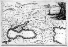 SCHWARZES MEER. - Karte. - Sarmatia. Zeigt das Gebiet vom Schwarzen Meer mit Donaumündung bis zum Kaspischen Meer mit Wolgamündung, im Süden die nördliche Türke und die Grenzgebiete zum Iran.
Kupferstich nach Chr. Cellarius bei J.B. Ghisi, Rom, 1774, 30 x 45 cm.
T. VIII aus: "Cellarius' Geographica Antiqua in Compendium Redacta". - Mit den heutigen Ländern Kasachstan, Kaukasien, Georgien, Armenien, Aserbeidschan usw. in der An... (Artikelnr. 30203EG)
Erfahren Sie mehr180,00 € Inkl. MwSt. -
 FRANKREICH. - Karte. - Gebietskarte von Frankreich mit der Champagne, Borgogne und Borrois. Zeigt das Gebiet zwischen Chateau Villain im Norden, Semür im Westen, Dijon und Auxonne im Süden, Besancon und Faverny im Osten.
Grenzkol. Kupferstich von G. F. Abel bei W. Jaeger, um 1780, 47 x 62 cm.
Blatt 65 der "Carte Topographique d'Allemagne". (Artikelnr. 11874AG)
Erfahren Sie mehr142,00 € Inkl. MwSt. -
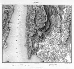 GARDA/am Gardasee. - Karte. - Rivoli. Kleinteilige Umgebungskarte von Garda mit Punta San Vigilio, im Westen die Seefläche mit Gegenufer, im Osten das Etschtal mit Rivoli.
Kupferstich von Dyonnet nach Duvotenay aus Lavallée bei Furne, Paris, 1858, 20 x 24 cm.
Aus: Théophile Lavallée's "Atlas de Géographie Militaire". - Zeigt im Osten den Lauf der Adige von Rivalta bis Pontone und das Gebiet um Rivoli Ver... (Artikelnr. 34868EG)
Erfahren Sie mehr100,00 € Inkl. MwSt. -
FRANKREICH. - Karte. - Normandie, Bretagne, Maine, Anjou, Touraine, et Saumurois. Gebietskarte, im Westen bzw. Norden die Atlantikküste von der Loire-Mündung bis Dieppe, im Süden die Loire, mit Einteilung in vierzehn Départements.
Grenzkol. Kupferstich von Dussy nach Delamarche und Robert de Vaugondy, Paris, um 1800, 24 x 30 cm.
Aus "Nouvel Atlas Portatif". - Zeigt oben die englischen Kanalinseln. (Artikelnr. 32369EG)
Erfahren Sie mehr94,00 € Inkl. MwSt. -
 FRANKREICH. - Karte. - Gebietskarte mit Orleans, Champagne und Bourgogne. Umfasst das Gebiet zwischen Villeneuve im Norden, Bois Communs und Sully sur Loire im Westen, La Charité im Süden sowie Noyers und Avallon im Osten.
Kupferstich von G. F. Abel bei W. Jaeger, um 1780, 47 x 62 cm.
Blatt 64 der "Carte Topographique d'Allemagne". (Artikelnr. 11870AG)
Erfahren Sie mehr133,00 € Inkl. MwSt. -
FRANKREICH. - Karte. - Flandre Francoise, Picardie et Artois, Isle de France, Orléanois, Champagne, Loraine er Alsace. Gebietskarte von der Atlantikküste bei Calais im Nordwesten entlang der Belgisch-Luxemburgischen Grenze bis zum Rhein
Grenzkol. Kupferstich von Dussy nach Delamarche und Robert de Vaugondy, Paris, dat. 1806, 24 x 30,5 cm.
Aus "Nouvel Atlas Portatif". - Zeigt im Zentrum Paris. (Artikelnr. 32367EG)
Erfahren Sie mehr94,00 € Inkl. MwSt. -
 FRANKREICH. - Karte. - Gebietskarte mit Orleans, Champagne und Bourgogne. Umfasst das Gebiet zwischen Villeneuve im Norden, Bois Communs und Sully sur Loire im Westen, La Charité im Süden sowie Noyers und Avallon im Osten.
Grenzkol. Kupferstich von G. F. Abel bei W. Jaeger, um 1780, 47 x 62 cm.
Blatt 64 der "Carte Topographique d'Allemagne". (Artikelnr. 11871AG)
Erfahren Sie mehr114,00 € Inkl. MwSt. -
 BELGIEN. - Karte. - Gebietskarte der Grafschaft Namur, des Bistums Liège, der Herzogtümer Limburg und Bouillon sowie Luxemburg. Umfasst das Gebiet zwischen Nivelles und Verviers im Norden, im Westen Beaumont, im Süden Sedan und Luxembu
Kupferstich von D. A. Hauer bei W. Jaeger, um 1780, 47 x 61 cm.
Blatt 38 der "Carte Topographique d'Allemagne". (Artikelnr. 11856AG)
Erfahren Sie mehr114,00 € Inkl. MwSt. -
FRANKREICH. - Karte. - Poitou, Aunis, Saintonge et Angoumois, La Marche, Limosin, et Auvergne. Gebietskarte, im Westen die Atlantikküste von der Loire-Mündung bis Bordeaux, im Osten die Dauphiné, mit Einteilung in zehn Départements.
Grenzkol. Kupferstich von Dussy nach Delamarche und Robert de Vaugondy, Paris, dat. 1806, 24 x 28,5 cm.
Aus "Nouvel Atlas Portatif". - Zeigt im Norden den Flußlauf der Creuse, im Süden den der Dordogne. (Artikelnr. 32368EG)
Erfahren Sie mehr94,00 € Inkl. MwSt. -
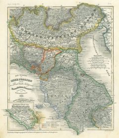
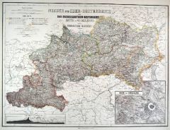
SLOWENIEN. - Karte. - Die Herzogthümer Steiermark, Kärnten, Krain, die gefürstete Grafschaft Görz und Gradika, die Markgrafschaft Istrien, die Stadt Triest mit Gebiet (als Nebenkarte) und das ungarische Littorale.
Grenzkol. Kupferstich von Geyer und Szen nach Gräf, Weimar im Geograph. Institut, 1872, 66 x 53,5 cm.
Espenhorst, PP 1.1.6. - Aus: Heinrich Kiepert's "Grosser Hand-Atlas" (43. Ausgabe, Auflage 1872). - Gewann 1871 die einzige Goldmedaille... (Artikelnr. 35516EG)
Erfahren Sie mehr130,00 € Inkl. MwSt. -
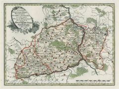
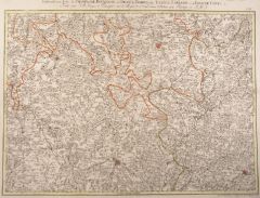
 LOTHRINGEN. - Karte. - Gebietskarte von Lothringen mit Teilen von Luxemburg und der Champagne. Zeigt das Gebiet zwischen Longwy, Mouzon und Signy im Norden, im Westen bis Rethel, um Süden Menehould und Tilly, im Osten Metz und Thionville.
Kupferstich von G. F. Abel bei W. Jaeger, um 1780, 47 x 62 cm.
Blatt 47 der "Carte Topographique d'Allemagne". (Artikelnr. 11894AG)
Erfahren Sie mehr142,00 € Inkl. MwSt. -
SIBIRIEN. - Karte. - Scythia et Serica. Zeigt das Gebiet vom Kaspischen Meer mit Wolgamündung bis zum Ochotskischen Meer, im Norden "Terra incognita" und das Eismeer, im Süden die Grenze zu Indien und China.
Kupferstich nach Chr. Cellarius bei J.B. Ghisi, Rom, 1774, 30 x 45 cm.
T. XXIX aus: "Cellarius' Geographica Antiqua in Compendium Redacta". - Mit den heutigen Ländern westlich und östlich des Altai-Gebirges (Scythia intra bzw. extra Imau... (Artikelnr. 30202EG)
Erfahren Sie mehr160,00 € Inkl. MwSt. -
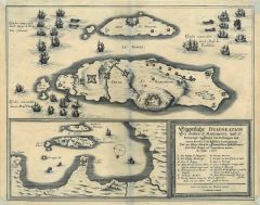 ANTIBES. - Karte. - Küstenkarte mit dem Cap d' Antibes und den Inseln St. Marguerite und St. Honorat im Grundriß, darüber als Sonderkarte die "Eigentliche Delineation Der Insuln S. Margarite und St. Honorat" mit allen Festungen, auf de
Kupferstich von Merian, um 1640, 115 x 22 cm (Küstenkarte) bzw. 16 x 34 cm (Inseln).
Mit geglättetem Mittelbug und hinterlegten Eckausrissen. (Artikelnr. 12955EG)
Erfahren Sie mehr140,00 € Inkl. MwSt. -
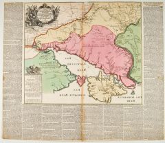
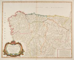 KASTILIEN. - Karte. - Partie Septentrionale de la Couronne de Castille ou se trouvent les Royaumes de Castille Vieille de Leon, de Gallice, des Asturies, la Biscaye et la Navarre. Zeigt den Norden Spaniens von Toledo bis zur Küste mit de
Altkol. Kupferstich von R. de Vaugondy, Paris, 1752, 47,5 x 58,5 cm. (Artikelnr. 42458EG)
Erfahren Sie mehr450,00 € Inkl. MwSt. -
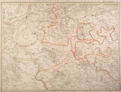
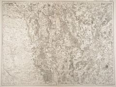
 BÖHMEN. - Karte. - Nachtrag zu dem ersten Plan deren Positionen beyder kaiserl. königl. und K.preußischen Armeen in Böhmen, die bis gegen ersten Sept. 1778 vorgefallenen Attaquen vorstellend. 6 Schlachtenpläne auf einem Blatt, jeweil
Kupferstich, um 1780, 40 x 51 cm.
Zeigt die Stellungen in der Lausitz am 29. Juli und 1. August 1778, bei Gabel am 2. August 1778, bei Teschen am 11. August, bei Melnik am 27. August und im Erzgebirgskreis im August und September 1778. Mi... (Artikelnr. 16073CG)
Erfahren Sie mehr180,00 € Inkl. MwSt.